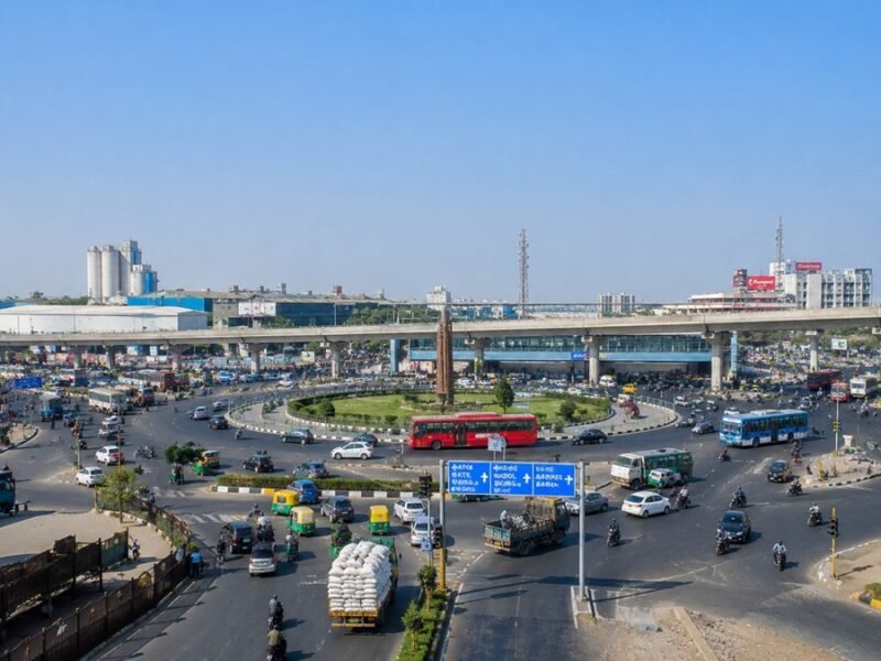

Narol Circle is one of the busiest and most recognised road junctions in southeastern Ahmedabad. Whether you are a daily commuter, a truck driver heading to the Vatva industrial belt, a student looking for a college route, or someone considering property in Narolgam — this guide covers everything you need to know about Narol Circle Ahmedabad.
What is Narol Circle?
Narol Circle is a major road junction located in the southeastern part of Ahmedabad, Gujarat. It serves as the functional entry point into Narolgam — a dense, largely working-class locality that sits at the crossroads of residential housing and industrial movement.
The circle is not a formal flyover or underpass structure; it is a busy at-grade junction where multiple roads converge, creating a high-traffic node that trucks, AMTS buses, two-wheelers, and daily commuters pass through at almost every hour of the day. Think of it less as a landmark and more as a living pulse point for everything southeastern Ahmedabad represents.
Quick Answer: Narol Circle is a key road junction in southeastern Ahmedabad, serving as the entry point to Narolgam (PIN: 382405). It connects industrial freight routes to the Vatva GIDC belt, residential areas, and the city’s BRTS public transport network.
Where is Narol Circle Located?
Narol Circle sits in the Narolgam area of Ahmedabad South, under the jurisdiction of the Ahmedabad Municipal Corporation (AMC). The PIN code for this area is 382405.
The circle borders four important localities:
- Narol (south)
- Vatva (southeast)
- Isanpur (east)
- Govindwadi (north)
These four localities together define the industrial-residential corridor of Ahmedabad’s southeastern edge.
Key Location Details
| Detail | Information |
|---|---|
| City | Ahmedabad, Gujarat |
| Zone | Ahmedabad South |
| PIN Code | 382405 |
| Nearby Landmark | Swastic Center, Dr. K.B. Bhagatariya Hospital |
| Distance from Kankaria Lake | ~4 km north |
| Distance from Chandola Lake | ~1.5 km north |
| Airport Distance | ~11 km from Sardar Vallabhbhai Patel International Airport |
Why is Narol Circle Important?
Narol Circle carries a dual character that makes it stand out from other circles in Ahmedabad.
First, it handles industrial freight. The Vatva GIDC — one of Ahmedabad’s oldest industrial estates — lies roughly 6 km from the area, and the Narol–Vatva Road corridor is heavily used by trucks carrying chemicals, textiles, engineering components, and packaging materials. Goods vehicles coming from the state highway network pass through Narol Circle every day.
Second, it handles everyday residential traffic. Tens of thousands of people live in Narolgam, Isanpur, and Govindwadi. Factory workers, students, shop owners, and office employees all use the circle for their daily commute.
This combination makes Narol Circle one of the busiest junctions in the city’s southern half, with peak congestion levels that rival areas several times more expensive.
Narol Circle Map Overview
You can locate Narol Circle on Google Maps by searching “Narol Circle Ahmedabad” or “Narol Circle Narolgam.” The circle sits near the Narol–Naroda Highway and is within accessible distance of the SP Ring Road (Sardar Patel Ring Road) — the city’s orbital road system.
Nearby Landmarks at a Glance
| Landmark | Direction from Narol Circle | Approx. Distance |
|---|---|---|
| Swastic Center | Adjacent | <100 m |
| Dr. K.B. Bhagatariya Hospital | ~120 m southwest | <200 m |
| Chandola Lake | North | ~1.5 km |
| Jethabhai’s Stepwell (Isanpur) | East | ~1.5 km |
| Kankaria Lake | North | ~4 km |
| Maninagar | Northeast | ~3.5 km |
| Jamalpur | North | ~4.5 km |
| Sardar Vallabhbhai Patel International Airport | Northwest | ~11 km |
Ahmedabad to Narol Distance
The distance from Ahmedabad city centre (Lal Darwaja) to Narol Circle is approximately 8–10 km, depending on the route you take.
Distance & Travel Time Table
| Starting Point | Distance to Narol Circle | Approx. Travel Time (Normal Traffic) |
|---|---|---|
| Lal Darwaja (City Centre) | ~8 km | 25–35 minutes |
| Maninagar Railway Station | ~2.8 km | 10–15 minutes |
| Ahmedabad Junction (Kalupur) | ~6 km | 20–30 minutes |
| Kankaria Lake | ~4 km | 12–18 minutes |
| Vatva Railway Station | ~4.5 km | 15–20 minutes |
| Sardar Vallabhbhai Patel International Airport | ~11 km | 30–40 minutes |
| SP Ring Road (nearest point) | ~2–3 km | 8–12 minutes |
Narol to Ahmedabad Distance
Narol Circle to Ahmedabad city centre is the same distance in reverse: approximately 8–10 km. If you are starting from Narol Circle and heading into the city, the most common routes are:
- Via Narol–Naroda Highway → Maninagar → LG Hospital Road → Kankaria Road: Good for reaching Kankaria, Maninagar, and the eastern parts of the city.
- Via Isanpur Road → Vatva Road → Rajpur Road: Useful for connecting to the southern belt.
- Via SP Ring Road (when accessible): Best for longer-distance city bypass travel.
How to Reach Narol Circle
By Road (Private Vehicle)
From Lal Darwaja, take Raikhad Road → Relief Road → Maninagar → Narol Road → Narol Circle. The journey takes about 25–35 minutes in normal traffic.
From the Airport, head south via SP Ring Road → take the Isanpur/Narol exit → Narol Circle. This takes approximately 30–40 minutes.
By Auto-Rickshaw
Auto-rickshaws are widely available at Maninagar Railway Station and Isanpur Bus Stand. Fare from Maninagar to Narol Circle is typically ₹50–80 by meter.
By Train
The nearest railway stations are:
- Maninagar Railway Station (~2.8 km from Narol Circle)
- Vatva Railway Station (~4.5 km from Narol Circle)
Both stations connect to Ahmedabad Junction (Kalupur) — the main railway hub of the city.
Narol BRTS Connectivity
Narol Circle is well-served by Ahmedabad’s Janmarg BRTS (Bus Rapid Transit System), operated by Ahmedabad Janmarg Limited.
The Narol BRTS station is one of the key stops on the city’s north-south BRTS corridor. BRTS Route 7D (Narol BRTS to DCIS Circle / Zundal Circle) covers 38 stops across the entire north-south axis, making it one of the most useful routes for daily commuters travelling between south and north Ahmedabad.
Key BRTS Routes Serving the Narol Area
| Route | From | To | Key Stops |
|---|---|---|---|
| 7D | Narol BRTS | DCIS Circle (Zundal Circle) | 38 stops, covers full N-S corridor |
| 12D | Narol | Northern Ahmedabad | Crosses via city centre |
| 6D | Narol area | City centre | Connects to Lal Darwaja direction |
| 5D | Area routes | Cross-city | AMTS BRTS overlap |
| SP1 | Narol Circle area | Cross-city express | Last service ~10:22 PM |
The Narol Circle AMTS bus stop serves multiple routes including 12U, 14, 22, 22/1, 5U, 5D, 6D, 7D, 12D, SP1, and several E-series routes. The first service starts at 7:19 AM and the last service (SP1) runs until approximately 10:22 PM.
The nearby Narol BRTS station (a few hundred metres from the circle) serves even more routes — 6U, 12U, 5D, 5U, 7S, 7U, 7D, 12D, 6D, 6E, 7E — with the first BRTS service starting at 6:00 AM and the last at 11:33 PM.
Nearby Metro Connectivity
At present, Narol Circle does not have a direct Metro station within walking distance. However, the area is connected to the metro network via feeder transport.
The nearest Metro stations accessible from Narol Circle are:
- Kankaria East Metro Station (Ahmedabad Metro Line 1) — approximately 4 km away
- Jivraj Park Metro Station (Line 1) — accessible via Maninagar
- Maninagar Metro Station — accessible via Maninagar Road
For longer-distance metro travel, commuters from Narol Circle typically take an AMTS bus or auto to Maninagar, then catch Metro Line 1 northward into the city.
Public Transport Options
| Mode | Availability | Notes |
|---|---|---|
| AMTS Bus | High | Multiple routes, last bus ~10:22 PM |
| Narol BRTS | High | First service 6:00 AM, last 11:33 PM |
| GSRTC (State Bus) | Moderate | Services to Vadodara, Surat, Gandhinagar |
| Auto-Rickshaw | Very High | 24-hour availability |
| Cab (Ola/Uber) | High | Available via app |
| Local Trains | Moderate | Maninagar & Vatva stations nearby |
Traffic Conditions at Narol Circle
Traffic congestion at Narol Circle is a real daily challenge — and anyone planning to travel here should plan accordingly.
Peak hours are typically:
- Morning: 8:00 AM – 10:30 AM (factory shift starts, school traffic, office commuters)
- Evening: 5:30 PM – 8:00 PM (shift ends, return traffic from Vatva industrial belt)
The congestion is caused by a combination of heavy industrial goods vehicles, AMTS buses making stops, two-wheelers, and auto-rickshaws all sharing the same junction simultaneously. Residents and commuters have flagged this as an ongoing civic issue.
Practical tip: If you must pass through Narol Circle during peak hours, add 15–25 extra minutes to your estimated travel time. Mornings on weekdays are particularly heavy.
Major Roads Connected to Narol Circle
- Narol–Naroda Highway — the primary east-west connector for the southeastern belt
- SP Ring Road (Sardar Patel Ring Road) — within accessible distance, gives access to the city’s orbital bypass
- Narol–Vatva Road — connects to Vatva GIDC and the industrial corridor
- Isanpur Road — connects eastward to Isanpur and Govindwadi
Nearby Residential Areas
Narolgam and the Narol Circle zone attract residents primarily because of affordability. Property rates here are approximately ₹2,650 per square foot — less than half the city average of around ₹5,800 per sq. ft.
Key residential localities near Narol Circle:
| Locality | Approx. Distance | Character |
|---|---|---|
| Narolgam | Within 0.5 km | Affordable housing, factory workers |
| Isanpur | ~1–2 km | Mix of housing and small trade |
| Govindwadi | ~2–3 km | Working-class residential |
| Vatva | ~4–6 km | Industrial-adjacent housing |
| Maninagar | ~3.5 km | More developed, mixed residential |
Housing options include older row houses, mid-density apartment blocks, and newer society-style developments that have appeared over the past several years.
Nearby Industrial Areas
The industrial character of this belt is inseparable from how Narol Circle functions.
- Vatva GIDC — approximately 6 km from Narol. One of Ahmedabad’s oldest and most established industrial estates, with factories producing chemicals, textiles, engineering components, and packaging materials.
- Narol Industrial Area — textile units, small manufacturing clusters within the Narol locality itself.
- Narol–Vatva Corridor — lined with warehouses, godowns, and wholesale trade outlets selling building materials, auto parts, and industrial consumables.
For truck drivers and logistics operators, Narol Circle is essentially the gateway into this industrial zone from the city side.
Hotels Near Narol Circle
Narol is not a hotel district, but several budget and business hotels operate within a few kilometres of the circle, catering to industrial visitors, traders, and business travellers.
| Hotel | Area | Approx. Distance |
|---|---|---|
| Hotels in Maninagar | Maninagar | ~3–4 km |
| Budget guesthouses in Isanpur | Isanpur | ~1–2 km |
| Business hotels near Vatva Road | Vatva Belt | ~4–5 km |
For more options, travellers often prefer hotels in Maninagar or Kankaria areas, which offer better facilities while remaining reasonably close to Narol Circle.
Hospitals Nearby
Healthcare access near Narol Circle is adequate for a working-class residential area. Here are verified hospitals within accessible range:
| Hospital | Approx. Distance |
|---|---|
| Dr. K.B. Bhagatariya Hospital | ~120 m (very close) |
| Krishna Trust Hospital, Narol | ~1.2 km |
| Mediclaim Hospital, Narol | Within Narol area |
| Shree Shakti Charitable Trust Multi Speciality Hospital, Narol | Within Narol area |
| Swapn Health Care Hospital, Narol | Within Narol area |
| Janani Women and Children Hospital | Narol area |
| Narol ICU and Multi Speciality Hospital | Narol |
| Vraj Hospital | Vatva (~4–5 km) |
For serious emergencies, Civil Hospital Asarwa (~8–9 km) and VS Hospital are the major government referral centres.
Schools & Colleges Nearby
| Institution | Distance from Narol Circle |
|---|---|
| R P Vasani Juniors, Narol | ~1 km |
| Rajaram Vidhya Vihar Higher Secondary School | ~1–2 km |
| Academyc Heights Public Schools, Vatva | ~1–2 km |
| Muktajivan English School, Narol | Within Narol area |
| Smart Champs English School | Within Narol area |
| Kidzee Narol Branch | Within Narol area |
| Jivkorbhai Lallubhai High School | Narol area |
| KK Shah Jarodwala Science College | Narol area |
| AMC MET Medical College | Narol vicinity |
| The Lotus School, Isanpur | ~0.7 km |
Restaurants & Food Options
Narol Circle is a working-class junction, which means food options lean toward affordable, everyday eating rather than fine dining.
Common food options near the circle and in the surrounding streets include:
- Local dhabas and thali restaurants — serving Gujarati and north Indian thalis at ₹60–120 per person
- Tea stalls and snack corners — fafda-jalebi, vada pav, and chai are easily available from early morning
- Small restaurants on Narol–Naroda Highway — serving meals to truck drivers and factory workers
- Honest Restaurant — a well-known name in the broader Narol area for quick meals
For a proper sit-down meal, Maninagar (~3.5 km) has a wider range of restaurants.
Petrol Pumps & Essential Facilities
| Facility | Location |
|---|---|
| Gokulesh Petrol Pump | Near Narol Circle (landmark for Swaminarayan Business Park) |
| ATMs & Banks | Multiple branches within Narolgam and Isanpur |
| Post Office | Narol Post Office (serves PIN 382405) |
| Police Station | Nearest at Narol/Isanpur area |
| Govindwadi Vegetable Market | ~3 km from the circle |
Petrol pumps and auto repair shops are found along the Narol–Vatva Road and Narol–Naroda Highway approaching the circle, given the high volume of commercial vehicles in the area.
Shopping Areas Nearby
| Mall / Market | Distance from Narol Circle |
|---|---|
| 10 Acres Mall (Kankaria area) | ~4–5 km |
| Galaxy Super Mall, Ghodsar | ~3.6 km |
| Pushpam Pushpak Mall, Isanpur | ~2–3 km |
| Govindwadi Vegetable Market | ~3 km |
| Local street markets in Narolgam | Within 1 km |
For larger retail therapy — clothing, electronics, home furnishings — residents typically head toward Maninagar or Kankaria area malls, which are more developed.
Google Maps Navigation Tips
When searching for Narol Circle on Google Maps, use these specific search terms for best accuracy:
- “Narol Circle Ahmedabad” — gives the correct junction pin
- “Narol Circle Narolgam” — useful when searching near the Narolgam residential area
- “Narol BRTS Ahmedabad” — locates the nearby BRTS stop with transit directions
Tips for navigation:
- Enable real-time traffic on Google Maps before starting — peak hours can significantly change your estimated arrival time.
- If you are driving a heavy vehicle (truck/goods vehicle), avoid the 8–10 AM and 5:30–7:30 PM windows.
- For two-wheelers, internal lanes via Isanpur and Govindwadi can be faster than the main highway during peak hours.
- Save offline maps for this area if you visit frequently — network connectivity can be spotty during heavy traffic.
Best Time to Travel
| Purpose | Best Time |
|---|---|
| Passing through Narol Circle | 10:30 AM – 5:00 PM (midday window) |
| Commuting to Vatva GIDC | Early morning (before 8:00 AM) |
| BRTS travel | Available from 6:00 AM |
| Auto-rickshaw availability | All day, highest 7 AM – 9 PM |
| Grocery / market shopping | Early morning (7–9 AM) at Govindwadi |
Avoid the Monday morning rush specifically — it tends to be heavier than other weekdays as industrial shifts restart after the weekend.
Safety Tips
- Cross roads carefully at Narol Circle — it is an at-grade junction with heavy goods vehicle movement. Pedestrians should use designated crossing points where available.
- Keep your valuables secure in crowded buses and during peak-hour congestion. Pickpocketing risks rise when buses are overcrowded.
- Trucks have limited visibility at turns — when on a two-wheeler, never cut in front of large vehicles near the junction.
- Check BRTS timings via the Moovit app or AMTS official site before travel — route frequencies can vary on public holidays.
- In an emergency, dial 108 (ambulance) or 100 (police). The nearest hospital (Dr. K.B. Bhagatariya Hospital) is within 120 metres of the circle.
Frequently Asked Questions (FAQs)
Q1. What is Narol Circle?
Narol Circle is a major road junction in southeastern Ahmedabad, located in Narolgam (PIN: 382405). It serves as the entry point to Narolgam and connects industrial routes to Vatva GIDC with the city’s residential and public transport network.
Q2. Where exactly is Narol Circle in Ahmedabad?
Narol Circle is in the Ahmedabad South zone, in the Narolgam locality. It borders Narol, Vatva, Isanpur, and Govindwadi. The nearest big landmark is Kankaria Lake, approximately 4 km to the north.
Q3. How far is Narol Circle from Ahmedabad city centre?
Narol Circle is approximately 8–10 km from Lal Darwaja (Ahmedabad city centre). By road in normal traffic, this takes about 25–35 minutes.
Q4. How far is Narol Circle from Ahmedabad Airport?
Sardar Vallabhbhai Patel International Airport is approximately 11 km from Narol Circle. Travel time is 30–40 minutes depending on traffic.
Q5. Which BRTS routes serve Narol Circle?
The Narol Circle AMTS bus stop is served by routes including 12U, 14, 22, 5U, 5D, 6D, 7D, 12D, SP1, and several E-series routes. The nearby Narol BRTS station is also served by the important Route 7D (Narol BRTS to DCIS Circle/Zundal Circle, 38 stops).
Q6. Is there a Metro station near Narol Circle?
There is no Metro station within walking distance of Narol Circle currently. The nearest accessible Metro stations are Kankaria East and Jivraj Park, reachable by AMTS bus or auto from the circle.
Q7. What is the nearest railway station to Narol Circle?
Maninagar Railway Station is the closest, approximately 2.8 km away. Vatva Railway Station is about 4.5 km. Ahmedabad Junction (Kalupur) is roughly 6 km from Narol Circle.
Q8. What are the peak traffic hours at Narol Circle?
Peak congestion hours are 8:00 AM – 10:30 AM and 5:30 PM – 8:00 PM on weekdays. Heavy goods vehicles and factory shift traffic are the primary causes.
Q9. Are there hospitals near Narol Circle?
Yes. Dr. K.B. Bhagatariya Hospital is about 120 metres southwest of the circle. Krishna Trust Hospital is approximately 1.2 km away. Several other multi-speciality hospitals operate within the Narol locality.
Q10. What is the PIN code for Narol Circle / Narolgam?
The PIN code is 382405, served by the Narol Post Office.
Q11. Is Narol Circle good for property investment?
Narolgam around Narol Circle offers very affordable property at approximately ₹2,650 per sq. ft., which is less than half the Ahmedabad city average. It suits first-time buyers and industrial workers. Rental demand is steady due to proximity to Vatva GIDC.
Q12. What shopping options are available near Narol Circle?
Nearby shopping includes the Govindwadi Vegetable Market (~3 km), Galaxy Super Mall in Ghodsar (~3.6 km), Pushpam Pushpak Mall in Isanpur (~2–3 km), and the large 10 Acres Mall near Kankaria (~4–5 km).
Q13. What is the STD code for Narol Circle area?
The STD code (telephone area code) for Narol and surrounding Ahmedabad is 079.
Q14. Can I reach Narol Circle by GSRTC bus?
Yes. GSRTC (Gujarat State Road Transport Corporation) operates intercity services connecting Ahmedabad to Vadodara, Surat, Gandhinagar, and other cities. GSRTC buses connecting to these routes pass through or near the broader Narol area. Check the official GSRTC website for current schedules.
Conclusion
Narol Circle is much more than a traffic junction — it is the functional heart of southeastern Ahmedabad’s industrial-residential belt. It connects Narolgam’s affordable housing to the Vatva industrial corridor, links residents to the city-wide BRTS network, and sits at the crossroads of everyday life for thousands of workers, students, and families.
Whether you are commuting to the Vatva GIDC, looking for an affordable home in Narolgam, catching a bus toward Zundal, or simply passing through on a road trip — understanding Narol Circle’s layout, transport options, and best travel times will save you real time and frustration.
Use Google Maps with real-time traffic, plan your travel outside the 8–10 AM and 5:30–8 PM peak windows where possible, and you will find Narol Circle straightforward to navigate.