


Logistics managers, small business owners, and avid travelers all face a common challenge: accurately estimating the journey between two points. While knowing the names of cities is helpful, it often lacks the precision needed for calculating shipping costs, planning efficient delivery routes, or estimating travel time. This is where the specific data points of postal codes come into play.
Calculating the pin to pin distance—the distance between two specific postal index number areas—provides a level of granular accuracy that city-to-city estimates simply cannot match. For a logistics company, a difference of ten miles can mean thousands of dollars in fuel costs over a year. for a traveler, it can mean the difference between arriving at a hotel in time for dinner or getting stuck on a highway at midnight.
Understanding how to bridge the gap between these codes is essential for modern operations. Whether you are automating a supply chain or just trying to figure out how far a supplier is from your warehouse, mastering these calculations will save you time and money. This guide explores exactly how to perform these calculations, the tools available, and why they matter for your bottom line.
Understanding Pin Codes and Their Significance
Before measuring the distance between them, it is helpful to understand what a pin code actually represents. A Postal Index Number (PIN) or Zip code is a string of numbers (and sometimes letters) used by postal services to identify specific geographical delivery areas.
These codes are not random. They are structured hierarchically to organize a country into regions, sub-regions, sorting districts, and finally, specific delivery post offices. For example, the first digit usually indicates a broad zone, the second indicates a sub-zone, and the subsequent digits narrow down the location to a specific neighborhood or town.
Because they are tied to specific post offices or delivery zones, pin codes offer a static, reliable way to map geography. Unlike city limits, which can expand, or road names, which can change, postal codes remain relatively constant identifiers of location. This makes them the perfect data point for calculating precise distances.
Methods to Calculate Pin to Pin Distance
There are two primary ways to approach this task: leveraging modern digital tools or relying on traditional, manual methods. While manual calculation has its roots in cartography, digital solutions have become the standard for efficiency.
Online Tools and APIs
The most practical way to determine the pin code to pin code distance is through online calculators and Application Programming Interfaces (APIs). Tools like Google Maps Platform, Mapbox, or specialized logistics software allow users to input two codes and instantly receive accurate distance metrics.
These tools typically offer two types of distance:
- Geodesic (Air) Distance: The straight-line distance between two points “as the crow flies.”
- Road Distance: The actual driving distance, accounting for highways, turns, and traffic regulations.
For most businesses, APIs are the gold standard. They can be integrated directly into your website or ERP system, allowing for automated shipping cost calculations at checkout. However, free online tools are sufficient for occasional checks.
Manual Calculation Methods
Before the internet, distance was calculated using physical maps and scale rulers. Mathematically, if you have the latitude and longitude of two specific pin codes, you can use the Haversine formula to calculate the great-circle distance between them.
While scientifically fascinating, manual calculation is rarely practical today. It requires precise coordinates for the center of every pin code area, and the math does not account for road networks, traffic patterns, or terrain. Relying on these methods for business logistics would likely result in significant delays and inaccuracies.
Step-by-Step Guide to Using Online Tools
If you aren’t integrating an API and just need a quick answer, free online distance calculators are your best bet. Here is a simple workflow to get the pin code to pin code distance in km.
- Choose a Reliable Tool: Search for a dedicated distance calculator. Many logistics aggregator websites offer these for free to help you estimate shipping.
- Enter the Source Pin Code: Input the 6-digit (or 5-digit, depending on the country) code of your pickup location. Ensure you select the correct country if the tool is global.
- Enter the Destination Pin Code: Input the code for the delivery location.
- Select Distance Type: If the tool offers options, choose between “driving distance” (best for shipping) or “straight line” (best for air freight).
- Calculate: Hit the search or calculate button.
The tool will typically generate a map view along with the distance in kilometers or miles. Some advanced tools will also provide the estimated time of arrival (ETA) based on current traffic conditions.
Use Cases for Pin to Pin Distance Calculation
Why go through the trouble of entering specific codes rather than just city names? The specificity of this data unlocks several high-value use cases.
Logistics and Shipping
In the world of logistics, distance equals money. Carriers often use distance slabs to determine shipping rates. If a shipment is calculated based on a broad city center location, but the actual delivery address is 20 kilometers outside the city limits in a different pin code, the carrier might undercharge the client and eat the loss, or overcharge and lose the business.
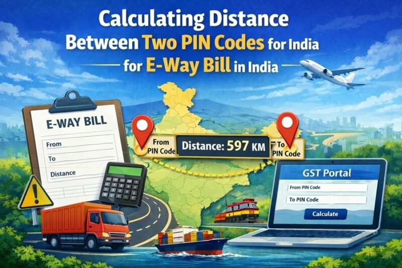
Furthermore, accurate distance is crucial for tax compliance in many regions. For instance, in countries with Goods and Services Tax (GST) regimes, generating an electronic waybill (E-way bill) for transporting goods often requires the exact distance. An error here can lead to regulatory fines. Calculating the pin to pin distance gst compliance requires is a standard procedure for generating valid transport documents.
Business Expansion
When a retail chain or service provider wants to expand, they need to know where their customers are. By analyzing sales data attached to customer pin codes, a business can map out “heat zones” of high demand.
If a company sees a cluster of orders coming from a specific set of pin codes that are far from their current warehouse, they can calculate the distance to see if opening a new fulfillment center in that area would reduce delivery times and costs.
Travel Planning
For travelers, especially those on road trips, knowing the exact distance between accommodations is vital. Hotels are often listed by the city they serve, but they might be located on the outskirts. By checking the distance between the pin code of your morning activity and the pin code of your hotel, you can plan a realistic itinerary that doesn’t leave you driving for hours longer than expected.
Advanced Tips and Considerations
While technology makes this process easier, there are nuances to keep in mind to ensure your data is actionable.
Accuracy of Data
Not all pin code databases are created equal. Postal services occasionally update codes, split regions, or create new delivery zones. If your pin to pin distance search returns an error, it might be because one of the codes is new or obsolete. Always cross-reference with the official postal service website of the respective country if you encounter discrepancies.
Limitations of Online Tools
Be aware that “pin code distance” is usually calculated from the centroid (geographic center) of one pin code area to the centroid of another. In rural areas, a single pin code can cover a massive geographic area. The distance from the center of the zone to the specific house address could add several kilometers to the trip. For hyper-local delivery services (like food delivery), pin-to-pin data might be too broad; specific address geocoding is often preferred in those scenarios.
Conclusion
Whether you are generating valid E-way bills for a fleet of trucks or planning a cross-country road trip, accuracy is your best friend. Calculating the pin to pin distance removes the guesswork from travel and logistics, providing a reliable metric for decision-making.
By utilizing modern online tools and understanding the distinction between road and air distance, you can optimize your operations, reduce costs, and ensure compliant, efficient travel. Don’t rely on rough estimates—plug in the codes and get the precision you need.